Quilt Gallery

Friday, January 29, 2021

Looking Back at 2020 Quilts

Now that it's 2021 I thought it would be nice to post all of last year's quilt finishes in one place. Of course, only one is an actual quilt at this point since I have avoided going into the shop where I could use a long arm machine to quilt them. Maybe things will change enough in 2021 for me to get them quilted and bound. So, here they are, in no particular order. 

The first one is Kaffe Fassett's "Facet" design, one of the few times I have used a published pattern. To make it more my own, I substituted a bunch of different fabrics instead of relying completely on Kaffe Fassett fabrics.


I named this mostly blue quilt "Sea Days" because it reminded me of the sparkling water that so mesmerized me during voyages to places like Antarctica and Svalbard, Norway.


I haven't thought of a name for this one. It's made from alternating quarter square triangles and solid blocks. I arranged the darks and lights to make stars pop out.


This scrap quilt made a pretty good dent in my scrap bin. I don't like it all that much, though I do think I'll appreciate it more once it is quilted. I used a die-cutter to cut out the triangles so it wasn't as much work as it might appear.


I found the center part of this quilt in my stack of WIPs (works in progress) pile and decided to expand it to a twin size quilt. The center was from the Sajou quilt along hosted by Humble Quilts back in 2018.


I think I finished this blue scrap quilt in 2019, but I never posted anything about it so I'm including it here. I pieced it by hand during various trips I took that year which seems like it must have been in a different lifetime! I am definitely looking forward to traveling again.


I didn't piece this corduroy quilt, but I did finish it for a friend of my mother's. I simply tied it and bound it. I love how the colors glow!


This last one was based on Denyse Schmidt's Free-Wheeling Single Girl quilt along. My version is very wonky because I made my own paper templates and I hand pieced all of it except for combining the blocks. This one will definitely benefit from quilting!


Monday, January 4, 2021

Easier Hikes in the Grand Tetons

In my last post I described several Grand Teton hikes that might be more challenging or time-consuming than everyone is up for, so here are five options on gentle terrain that offer beautiful scenery and even the possibility of seeing wildlife.

Taggart and Bradley Lakes (4 miles roundtrip to Taggart Lake, 6 miles roundtrip to both lakes, 550 feet elevation gain)

Park at the Bradley and Taggart Lake trailhead, a couple miles north of the Moose park entrance. If you find the lot full, an increasingly common occurrence due to the popularity of this hike, you may park along the west side of the road to the south of the lot. The trail is well signed and easy to follow and since it is a loop you can go clockwise or counterclockwise.

On clear days you will have lovely views of the high peaks, 

and see them reflected in the lakes.


Pick a spot along the lakeshore to enjoy your lunch along with the views.


Two Ocean and Emma Matilda Lakes (2 to 13 miles, up to 700 feet elevation gain, depending on route)

These two lakes are located on the opposite side of Teton Park Road from Jackson Lake Lodge. In spite of their proximity to this large visitor facility, trails around them tend to have much less traffic than others in the park. With gentle gradients and many different route options, they offer a lovely respite from the hustle and bustle often found on other trails. You are also likely to encounter wildlife, such as this deer. Be prepared with bear spray. We have seen both grizzly and black bears while hiking here.

Because there are so many options, I suggest consulting a map to help you choose your route and where to park. You can hike around just one of the lakes, or make a day of it and go around both lakes. You can also make it a very short day and simply hike to the Grand View Point. Here is Two Ocean Lake seen from the Grand View Point.

You'll also be rewarded with views of the entire Grand Teton Range. It was smoky when we visited this summer so I embraced the silhouette rather than a detailed color image.


Hermitage Point (10 miles roundtrip, 380 feet elevation gain)

The trailhead for this hike is at the southwest end of Colter Bay Visitors area, just past the marina office. Once again I suggest consulting a good map since this area has a number of trails and it isn't always clear which is the route to Hermitage Point. A map will also show you several shorter loop options if you don't want to go all the way to Hermitage Point.

About half of the hike runs along or near the eastern shore of Jackson Lake so there are many view points from which to see the Teton range.


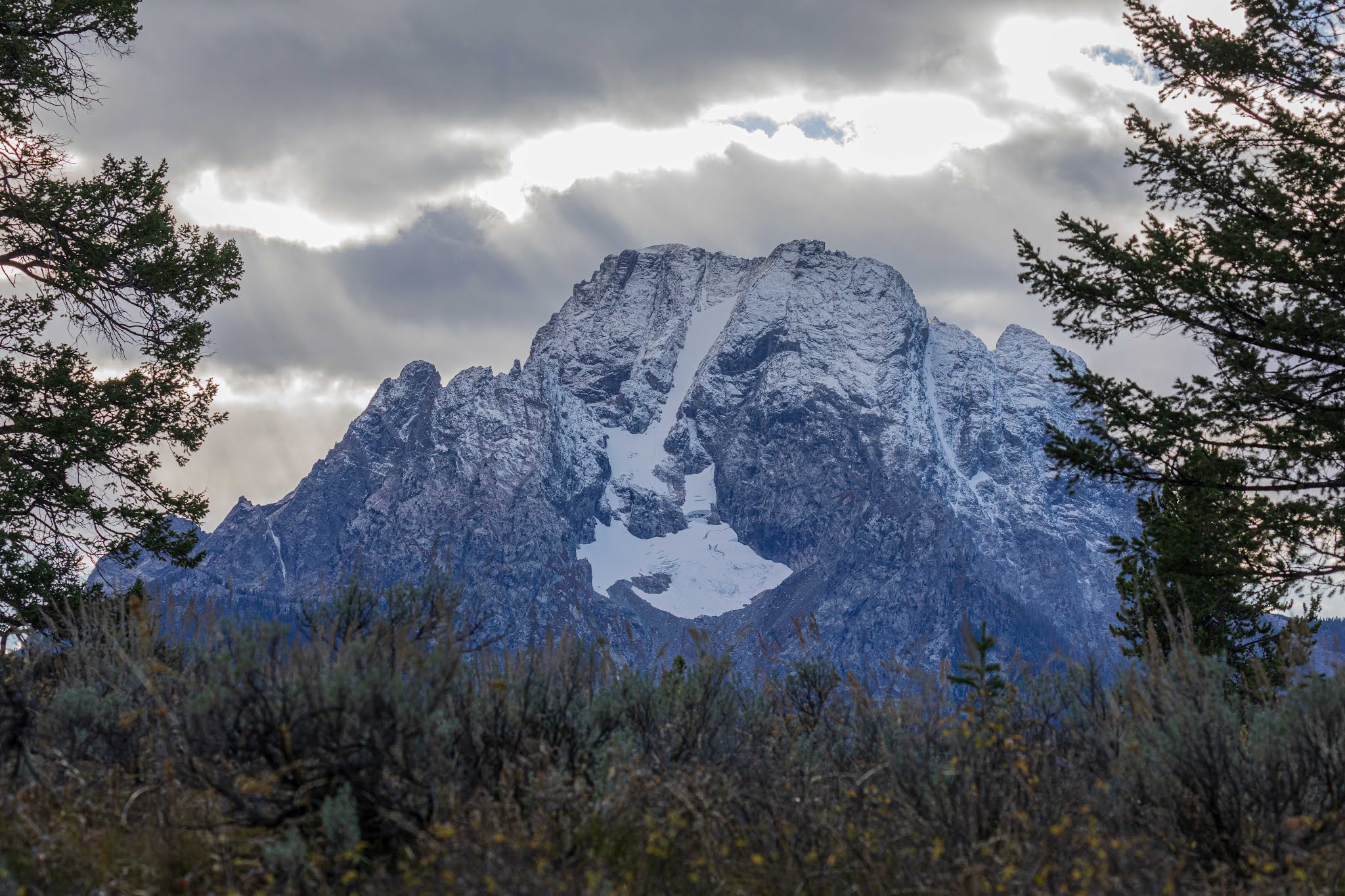
Mount Moran looms up from the opposite side of Jackson Lake. Here you see it with a dusting of early season snow and a good view of the Skillet Glacier.


String Lake (3.8 mile loop, 275 feet elevation gain)

String Lake trailhead is a few miles north of Jenny Lake. Simply follow the signs from the Teton Park Road to reach the parking lot. 

This is another very popular destination, especially in the summer when swimmers come to the lake to cool off. Best to arrive early to get a parking spot. When you're done with your hike then you can wash off the dust in the cool, clear water. It's also common to see bears here so be sure to keep any food with you at all times, and put it in a bear box or your car when you go swimming.

Phelps Lake from the Laurance S. Rockefeller Preserve (7 mile loop, 725 feet elevation gain)

Laurance S. Rockefeller Preserve (LSR) is accessed from Moose-Wilson Road and is the only attended parking lot in the park, because Laurance Rockefeller wanted to keep this parcel a place for quiet and contemplation. There are a strictly limited number of parking spaces and you must wait in line to be assigned one.  


The benefit of the controlled parking is that the trails do tend to be quiet, though as you get to the far end of Phelps Lake you may encounter more hikers coming from White Grass, many of whom are headed to the big rock from which to jump into the lake. In the late summer it is a popular spot for bears to browse on huckleberries so keep your eyes open!


It's January now, so these hikes aren't really an option now, (though some of them can be accessed on cross country skis) so I will wish you happy dreams of happy trails in the seasons to come.


Thursday, September 24, 2020

Great Hiking Destinations in Grand Teton National Park

In my last post I wrote about the challenges and joys of climbing Mt. Moran in Grand Teton National Park. Fortunately, climbing is not the only way to enjoy this magnificent park. Reasonably fit hikers can reach many interesting and scenic destinations in a day or less. In this post I'll detail three options -- Delta Lake, Lake of the Crags, and Static Peak -- that I have visited in the last month.  

Delta Lake (8 miles roundtrip, 2,370 feet elevation gain)

Start this hike at Lupine Meadows trailhead and follow the trail towards Amphitheater Lake. You may well see wildlife along the way, like this elk.

At the first switchback after the junction to Garnet Canyon, turn off onto an unofficial and unmaintained but clear path on the right. You are now in Glacier Gulch and will need to be more careful since the route has some steep and meandering sections and crosses a boulder field.


Delta Lake is a dramatic milky aqua, due to rock flour from the Teton Glacier above it. In clear weather you can see the Grand Teton looming in the distance but we were there in a surprise late August storm and instead found the lake socked in with snow and fog. It was magical.


This used to be one of the less visited high lakes, but social media has changed that. It is quite a popular spot now and I would only ask that visitors respect others' enjoyment of this beautiful lake by not playing loud music and trying to stay on the existing path instead of trampling down new ones. 

Lake of the Crags (5 miles roundtrip, 2,690 feet elevation gain)

Begin this hike at the west shore dock of Jenny Lake -- you can take the boat across (for a fee) or hike around from the Jenny Lake parking area -- and head north, going towards String Lake. In about a quarter mile, look for a well worn, but unmarked, trail on the left. This unofficial and unmaintained trail up Hanging Canyon climbs more steeply than official park trails so you may want to have hiking poles, especially for the descent. As you're walking look up for close-up views of the Cathedral Group,

and down for a great view of Jenny Lake.

Towards the top you will need to navigate across a small boulder field adjacent to Arrowhead Pool, then scramble up a short, rocky defile which will bring you out near Ramshead Lake. 

Continue along the path on the north side of Ramshead and then climb up the boulder field to reach Lake of the Crags. 

Surrounded by steep cliffs on three sides, it is a stunning place. On warm days you may enjoy a refreshing swim, or just lounge at the edge of the lake and take in the spectacular views.


Static Peak (16 miles roundtrip, 4,500+ feet elevation gain)

Start this hike at Whitegrass trailhead, accessed from the Moose-Wilson Road. Be prepared for rough going -- enormous potholes and large rocks abound -- on the last mile of road to the trailhead. Follow the Death Canyon trail for 3.7 miles, hiking up and over a moraine and passing the Phelps Lake overlook, to a patrol cabin. 


Turn right onto Alaska Basin Trail towards Static Peak Divide. 


This lovely trail begins in aspen, winds across evergreen forest and narrow cliffside paths, and finally brings you to the open and rocky Static Peak Divide at 10,790 feet of elevation. 


Now look for an obvious path on your right, 


and follow this along the right side of the ridge line all the way to the top of Static Peak. It is wise to keep an eye on the weather in this area as the name Static Peak derives from the peak's propensity to attract lightning.


From the summit you will have sweeping views of the trail you just traversed,


of Idaho to the west, and of the Grand Teton range, including the Grand itself in the distance. 


Looming up just to the north is the impressive edifice of Buck Mountain.


Like all the Grand Teton canyons, Death Canyon hosts abundant wildlife, such as this moose family we encountered on our return trip, so it is an interesting and worthy outing even if you don't reach the summit.  Also remember that near the end of the hike you will have to climb back up the moraine to the Phelps Lake overlook before the final stretch to your car. It can be disheartening to unexpectedly face that climb at the end of a long day.


If all of these hikes are beyond your comfort zone or simply require more time than you have, I'll write another post soon with suggestions for easier and shorter hikes in the area. 


Thursday, September 10, 2020

Climbing Mt. Moran in Grand Teton National Park

When most people think of Grand Teton National Park, they naturally think of the Grand Teton, the mountain which gives the parks its name and the range's tallest mountain. Frequent readers may remember that I climbed the Grand in 2018. Late last month I climbed another of the range's prominent peaks, Mt. Moran. 


Moran stands out on the northern end of the range, easily visible from Leigh and Jackson Lakes, the Jackson Lake Lodge, and the park road. Distinctive for its sheer massiveness, flattish top, and enormous, dark, nearly vertical dike jutting out from its eastern side. It is aptly named after Thomas Moran, the landscape artist who painted many dramatic and influential scenes of the American west.

Moran presents some very different challenges to the climber than does the Grand Teton, beginning with a canoe trip across String and Leigh Lakes to reach the approach climb up the stream flowing out of Falling Ice Glacier.


Then begins an unrelentingly steep two mile (and 2700 vertical feet) hike to camp. For most of the hike, you can see the West Horn and the East Horn on either side of the glacier, displaying the classic U shape profile of glacially carved valleys.


Eventually you bear off to the left onto a glacial moraine where the camp is located. Judging from the rock walls build around obvious tents sites, high winds are common in this area. Here's a view looking out of our tent door at the wall.


After an early dinner and arranging gear for a pre-dawn start I snuggled into my sleeping bag. And mostly didn't sleep because I was just too nervous thinking of the day ahead. It was a relief when it was finally time to get up and get going, headlamps lighting our way. 

It turns out we were in for a long day - nearly 12 hours from camp to the top and back down to camp, which is pretty typical for this climb - and another factor differentiating it from the Grand. Our aim was to follow the Chicago Mountaineering Club (CMC) route so we scrambled and climbed our way to the top of Drizzlepuss, a tower between the West Horn and the east face of Moran, then rappelled down to reach the east face which we then climbed in multiple pitches to reach the summit. For scale, you can see two climbers on the east face (in the middle of the lefthand side of the photo).


Throughout the day we moved slowly but steadily, thanks to our expert guide, Jed Porter, of Exum Mountain Guides. He knows the route in detail, pitch by pitch, which allowed us to avoid any route-finding delays, and he worked efficiently to set up the ropes to keep us safe. Since we climbed and rappelled one at a time I had a few opportunities to snap photos of the incredible scenery. This one is a view of the Falling Ice Glacier wedged between the East Horn and the West Horn. On the right hand side you can see Leigh Lake which we had paddled across the previous day.


Here is a close-up view of the dike. I have heard it called the "black dike," but it is really reddish brown. Regardless of its color, at 125 feet thick it is enormous!


And here we are at the top (with the Grand in the background) masks and all. Yes, we really did wear masks for much of the climb - any time we were close together, or about to be close together such as during belays and rappels. That's me on the left and if you're wondering why my shirt looks so lumpy, it's because my rappel gloves are stuffed inside.


For further proof that we reached the summit, here is my photo of the USGS summit bench mark. 12,605 feet above sea level, though the number is not engraved on the benchmark.


Here's one more view of the top, which, except for the dike, is comprised of Cambrian Flathead Sandstone, apparently none of it actually in place. Some blocks are in a random jumble, others form a patterned ground - geometrical shapes likely made by frost heaves.


After summit photos and a quick snack we turned back to camp, reversing our steps from the route up. This time though we rappelled down parts of the east face. Here is Jed setting up the ropes to rappel,


and here he is on the way down. Once again the views were stunning!


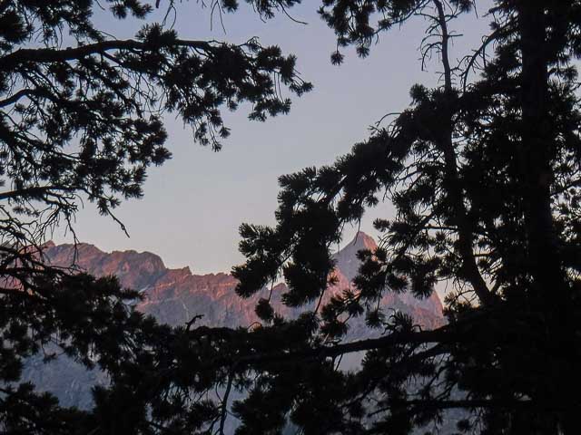
Then we reclimbed Drizzlepuss, which presented the trickiest maneuvers of the day, and which we fortunately handled without trouble. From there it was a scramble back to camp for a well-earned and delicious dinner of instant mashed potatoes and smoked oysters. Exhausted and exhilarated, we were back in our tents before sunset, though peeked out to see the high peaks glowing in the late evening light.


Though Moran may not be as famous as the Grand, it is a worthy climb in a stunning location. It offers more actual climbing than the Grand, though generally with less exposure. Spending two nights camping, rather than one in a hut, also gives you more time to enjoy the relative solitude of the back country.